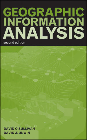
Geographic Information Analysis, 2nd EditionISBN: 978-0-470-28857-3
Hardcover
432 pages
March 2010
 |
||||||
Acknowledgments.
Preface to the First Edition.
1 Geographic Information Analysis and Spatial Data.
Chapter Objectives.
1.1 Introduction.
1.2 Spatial Data Types.
1.3 Some Complications.
1.4 Scales for Attribute Description.
1.5 GIS and Spatial Data Manipulation.
1.6 The Road Ahead.
Chapter Review.
References.
2 The Pitfalls and Potential of Spatial Data.
Chapter Objectives.
2.1 Introduction.
2.2 The Bad News: The Pitfalls of Spatial Data.
2.3 The Good News: The Potential of Spatial Data.
Chapter Review.
References.
3 Fundamentals-Mapping It Out.
Chapter Objectives.
3.1 Introduction: The Cartographic Tradition.
3.2 Geovisualization and Analysis.
3.3 The Graphic Variables of Jacques Bertin.
3.4 New Graphic Variables.
3.5 Issues in Geovisualization.
3.6 Mapping and Exploring Points.
3.7 Mapping and Exploring Areas.
3.8 Mapping and Exploring Fields.
3.9 The Spatialization of Nonspatial Data.
3.10 Conclusion.
Chapter Review.
References.
4 Fundamentals-Maps as Outcomes of Processes.
Chapter Objectives.
4.1 Introduction: Maps and Processes.
4.2 Processes and the Patterns They Make.
4.3 Predicting the Pattern Generated by a Process.
4.4 More Definitions.
4.5 Stochastic Processes in Lines, Areas, and Fields.
4.6 Conclusions.
Chapter Review.
References.
5 Point Pattern Analysis.
Chapter Objectives.
5.1 Introduction.
5.2 Describing a Point Pattern.
5.3 Assessing Point Patterns Statistically.
5.4 Monte Carlo Testing.
5.5 Conclusions.
Chapter Review.
References.
6 Practical Point Pattern Analysis.
Chapter Objectives.
6.1 Introduction: Problems of Spatial Statistical Analysis.
6.2 Alternatives to Classical Statistical Inference.
6.3 Alternatives to IRP/CSR.
6.4 Point Pattern Analysis in the Real World.
6.5 Dealing with Inhomogeneity.
6.6 Focused Approaches.
6.7 Cluster Detection: Scan Statistics.
6.8 Using Density and Distance: Proximity Polygons.
6.9 A Note on Distance Matrices and Point Pattern Analysis.
Chapter Review.
References.
7 Area Objects and Spatial Autocorrelation.
Chapter Objectives.
7.1 Introduction: Area Objects Revisited.
7.2 Types of Area Objects.
7.3 Geometric Properties of Areas.
7.4 Measuring Spatial Autocorrelation.
7.5 An Example: Tuberculosis in Auckland, 2001-2006.
7.6 Other Approaches.
Chapter Review.
References.
8 Local Statistics.
Chapter Objectives.
8.1 Introduction: Think Geographically, Measure Locally.
8.2 Defining the Local: Spatial Structure (Again).
8.3 An Example: The Getis-Ord Gi and Gi Statistics.
8.4 Inference with Local Statistics.
8.5 Other Local Statistics.
8.6 Conclusions: Seeing the World Locally.
Chapter Review.
References.
9 Describing and Analyzing Fields.
Chapter Objectives.
9.1 Introduction: Scalar and Vector Fields Revisited.
9.2 Modeling and Storing Field Data.
9.3 Spatial Interpolation.
9.4 Derived Measures on Surfaces.
9.5 Map Algebra.
9.6 Conclusions.
Chapter Review.
References.
10 Knowing the Unknowable: The Statistics of Fields.
Chapter Objectives.
10.1 Introduction.
10.2 Regression on Spatial Coordinates: Trend Surface Analysis.
10.3 The Square Root Differences Cloud and the (Semi-) Variogram.
10.4 A Statistical Approach to Interpolation: Kriging.
10.5 Conclusions.
Chapter Review.
References.
11 Putting Maps Together—Map Overlay.
Chapter Objectives.
11.1 Introduction.
11.2 Boolean Map Overlay and Sieve Mapping.
11.3 A General Model for Alternatives to Boolean Overlay.
11.4 Indexed Overlay and Weighted Linear Combination.
11.5 Weights of Evidence.
11.6 Model-Driven Overlay Using Regression.
11.7 Conclusions.
Chapter Review.
References.
12 New Approaches to Spatial Analysis.
Chapter Objectives.
12.1 The Changing Technological Environment.
12.2 The Changing Scientific Environment.
12.3 Geocomputation.
12.4 Spatial Models.
12.5 The Grid and the Cloud: Supercomputing for Dummies.
12.6 Conclusions: Neogeographic Information Analysis?
Chapter Review.
References.
Appendix A: Notation, Matrices, and Matrix Mathematics.
A.1 Introduction.
A.2 Some Preliminary Notes on Notation.
A.3 Matrix Basics and Notation.
A.4 Simple Matrix Mathematics.
A.5 Solving Simultaneous Equations Using Matrices.
A.6 Matrices, Vectors, and Geometry.
A.7 Eigenvectors and Eigenvalues.
Reference.
Index.


