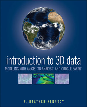
Introduction to 3D Data: Modeling with ArcGIS 3D Analyst and Google EarthISBN: 978-0-470-38124-3
Paperback
360 pages
June 2009
 |
||||||
Acknowledgments.
CHAPTER 1 Introduction to 3D Data: Modeling with ArcGIS 3D Analyst and Google Earth.
Exercise 1-1: Preview Data in ArcCatalog.
Exercise 1-2: Create a Layer File in ArcCatalog.
CHAPTER 2 3D Display in ArcScene.
Exercise 2-1: Set Background Color and Illumination in ArcScene.
Exercise 2-2: Set Vertical Exaggeration in ArcScene.
Exercise 2-3: Apply a Coordinate System to a Scene.
Exercise 2-4: Set 3D Layer Properties for an Elevation Raster.
Exercise 2-5: Set 3D Layer Properties for a Raster Image.
Exercise 2-6: Set Base Heights for a 2D Vector Layer.
Exercise 2-7: Extrude 2D Vector Features.
Challenge Exercise: View Regional Park Study Data in ArcScene.
CHAPTER 3 3D Navigation and Animation.
Exercise 3-1: Set Targets and Observers.
Exercise 3-2: Animated Rotation and the Viewer Manager.
Exercise 3-3: The Fly Tool.
Exercise 3-4: Create 3D Animated Films.
CHAPTER 4 ArcGlobe.
Exercise 4-1: Understanding ArcGlobe.
Exercise 4-2: Explore ArcGlobe’s Options, Add Data, and Redefine Layer Types.
CHAPTER 5 Google Earth.
Exercise 5-1: Navigating Google Earth’s Interface, and the Planet.
Exercise 5-2: Create a Polygon and Edit Its Properties Through Google Earth’s Form Menus.
Exercise 5-3: Edit the Gardens Polygon Using KML.
CHAPTER 6 Raster Surface Models.
Exercise 6-1: Interpolate a Terrain Surface with Spline.
Exercise 6-2: Interpolate Terrain with Inverse Distance Weighted and Natural Neighbors.
Exercise 6-3: Calculate Hillshade and Aspect.
Exercise 6-4: Calculate Slope.
Exercise 6-5: Calculate Viewshed.
Challenge Exercise: Calculate Viewshed and Slope Levels for Elk Park.
CHAPTER 7 TIN Surface Models.
Exercise 7-1: Create a TIN from Vector Features.
Exercise 7-2: Add Polygon Attribute Values to a TIN.
Exercise 7-3: Change TIN Symbology and Classification.
Challenge Exercise: Create a TIN of Elk Park.
CHAPTER 8 Terrain Surface Models.
Exercise 8-1: Create a Terrain Dataset.
Exercise 8-2: Rasterize a Terrain Dataset and View it in ArcGlobe.
CHAPTER 9 3D Features and More Surface Analysis Techniques.
Exercise 9-1: Convert 2D Features to 3D, and Digitize 3D Features in ArcMap.
Exercise 9-2: Draw a Line of Sight and a Cross-section Profile Graph.
Exercise 9-3: Calculate Surface Area and Volume on a TIN.
Challenge Exercise: Create Multipatch 3D Features.
CHAPTER 10 SKP to Multipatch to KML: Finalize the Elk Park Project.
Exercise 10-1: Convert a SketchUp File to a Multipatch Feature Class.
Exercise 10-2: View the Multipatch Feature Class in ArcGlobe.
Exercise 10-3: Export Layers from ArcMap to KML, and View Them in Google Earth.
About the Tutorial Data.
Index.


